Barbados Standpipes Map Project

Barbados standpipes
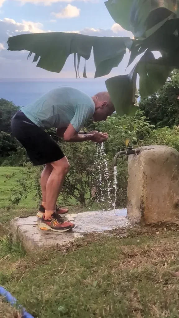
Ralf Luther enjoying a water break at a Barbados standpipe while out running.

Standpipes are another symbol of disappearing Barbados culture.

Public water standpipes were introduced across the island in 1861 following a devastating 1854 cholera epidemic.

The 1854 cholera epidemic in Barbados was a catastrophic public health event that caused 20,727  deaths. The epidemic exposed severe deficiencies in sanitation, housing, and water supply and served as a catalyst for significant public health and infrastructural reform in Barbados.

The most significant impact of the 1854 cholera epidemic was the realisation of the need for clean, piped water to prevent future outbreaks.

A piped water system was established, with construction completed in June 1861, installing roughly 400 standpipes across the island. These standpipes provided free, clean water to village communities, fundamentally improving public health. The standpipe project of 1861 brought water to Bridgetown from sources like Ben Spring in St. John via a 26-kilometer pipeline.

Standpipes served as vital social hubs for gatherings, gossip, and courtship, fundamentally shaping Bajan village life.

Standpipes in Barbados, once a vital source of public water, have gradually been decommissioned as piped water became available to individual households. However, many still remain – some preserved as historic landmarks.

Traditionally, standpipes are most commonly found in older neighbourhoods and rural villages.

Advertisements

In recent years, the government has also installed or rehabilitated standpipes in newer residential areas, particularly in communities that were previously informal settlements and are only now being integrated into formal utility networks such as electricity, natural gas, and water.

Despite modern infrastructure improvements, a number of standpipes across Barbados continue to be used daily, whether by nearby residents or by passing runners and hikers.
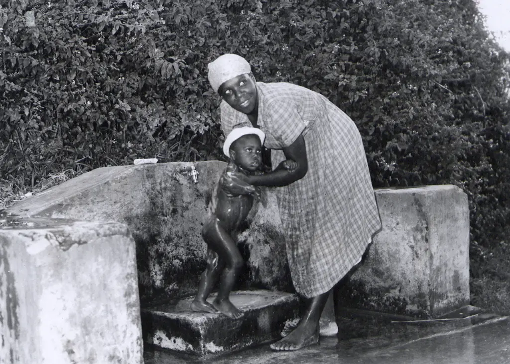
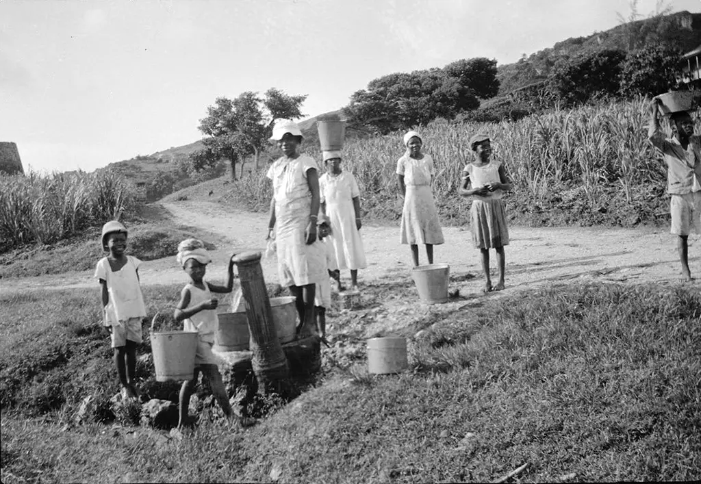
A Barbadian woman bathing her little boy under the communal tap near Bathsheba
‘A Barbadian woman bathing her little boy under the communal tap near Bathsheba’. Photograph No D77040 Official Barbados photograph compiled by Central Office of Information. Source: The National Archives UK

Google Maps – Standpipes of Barbados

The Google Map – Barbados Standpipes – is a project that Ralf Luther has been championing.

We urge you to view the Standpipes of Barbados map at full screen size by clicking on the link in the top right hand corner [ ] of the black ribbon. This will expand the map. Click on each icon for photos of individual standpipes.

  • Blue icons – Standpipe still works.
  • Yellow icon – known location of Standpipe but not yet logged.
  • Red icon – Standpipe not working or destroyed or has vanished.

Please mail comments or corrections for the Google Map – Barbados Standpipes to ralf@run246.com.

Click here for Ralf’s album of Barbados Standpipes.


If you enjoyed this post leave a comment…

Leave a Reply

Your email address will not be published. Required fields are marked *

This site uses Akismet to reduce spam. Learn how your comment data is processed.

Advertisements

Search BajanThings:

Help Us Share More Bajan Stories – Make a Donation:

BajanThings is a passion project dedicated to preserving and sharing Bajan culture, stories, and history.

Your support helps cover the annual costs of running the BajanThings website and fuels our mission to document and share Bajan stories for future generations.

We accept donations via Stripe and PayPal.

Thank you for your support!

Subscribe to BajanThings:

If you would like to be kept informed when there are updates to BajanThings please subscribe to our e-mail update notification. Whenever there is new content added to BajanThings, you will receive an e-mail telling you of the update:

Advertisements

Notice Board:

High Altitude Research Project (HARP) 1962 – 1967 has been updated with pictures of the landing of HARP at Foul Bay.

Thor Heyerdahl’s Ra Expeditions to Barbados: Ra I 1969, Ra II 1970 has been updated with some additional Black & White photos.

Barbados Oceanographic Research Facility 1957 – 1979 has been updated with some photos of the remnant underseas SOSUS cable.

The BajanThings 101 on AI chatbots has been updated for 2025 to include: ChatGPT, CoPilot, Gemini, DeepSeek, Grok (xAI) & Claude.

Lord Nelson’s statue – Bridgetown, Barbados has been updated following its removal on 16th November 2020 with details of the public subscribers and details about the forged Nelson-Taylor letter.

The Printed Maps of Barbados 1500 – 1980s has been updated and split into 5 sections: 1500s – 1700, 1700 – 1800, 1800 – 1900, 1900 – 1980s & Addendums.

P/O George HF Inniss: 31st May 1916 to 5th February 1941 has been updated.

St. Philip, Barbados in the 1950s & 1960s. A very brief recollection of the people and events updated to include details of the homemade helicopter built by Three Houses factory manager Bob Reece.

Do You Want The Truth Or Something Beautiful? The Empire Windrush story has been updated.

Errol Barrow – Statesman, Prime Minister of Barbados, RAF Navigator World War II has been updated.

Torpedoing of the Cornwallis in Carlisle Bay, Barbados, 11th September 1942 has been updated.

Memorials for departed friends has been updated, a fourth cairn has been added.

British Ship: Scottish Star Torpedoed – 19th February 1942 has been updated with a section on Michael Doyle AB.

Last 5 Comments:

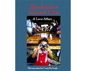
Barbados Island life: photographs and stories by Craig Burleigh that celebrate Barbados island life in the 1970s
Barbados Island life: photographs by Craig Burleigh that celebrate Barbados island life in the 1970s

Contact BajanThings:

Click on the: Contact us button below to go to the BajanThings contact page:

Advertisements